Land gravity survey is a geophysical method used to measure variations in the Earth’s gravitational field across a particular area of land. This technique provides valuable information about the density distribution and subsurface structure of the Earth.
Here’s an overview of how a land gravity survey typically works:
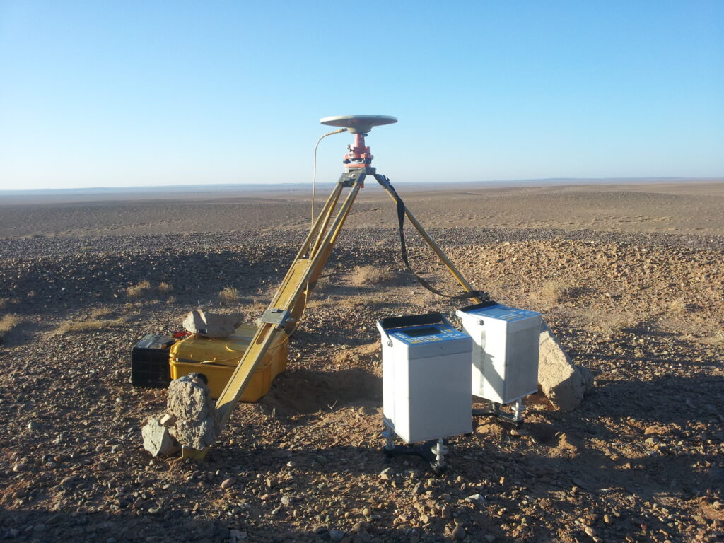
- Instrumentation: Gravity surveys use precise instruments called gravimeters to measure the gravitational acceleration at different points on the Earth’s surface. Gravimeters are highly sensitive devices that can detect very small changes in gravitational force.
- Data Collection: During a gravity survey, the gravimeter is carried to various locations across the survey area, and measurements are taken at each location. The spacing between measurement points depends on the objectives of the survey and the desired resolution of the data. Typically, measurements are taken along a grid pattern to ensure comprehensive coverage of the survey area.
- Data Correction: Gravity measurements are affected by various factors, such as the elevation of the survey points, the Earth’s rotation, and local geology. Therefore, collected data needs to be corrected for these effects to obtain accurate results.
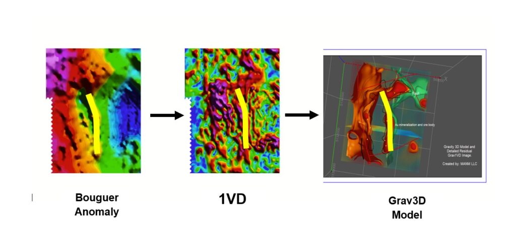
- Data Interpretation: Once the raw data is collected and corrected, it is interpreted to identify anomalies or deviations from the expected gravitational field. These anomalies can indicate variations in subsurface density, such as the presence of geological structures, mineral deposits, or hydrocarbon reservoirs.
- Mapping: The results of the survey are typically presented as contour maps, showing the distribution of gravity anomalies across the surveyed area. These maps can provide valuable insights into the subsurface geology and help in various applications, including mineral exploration, oil and gas exploration, groundwater studies, and geotechnical investigations.
Land gravity surveys are often conducted in combination with other geophysical methods, such as magnetic surveys and seismic surveys, to obtain a more comprehensive understanding of the subsurface properties of an area.