Ground magnetic survey is a geophysical technique used to measure variations in the Earth’s magnetic field caused by underlying geological structures, such as mineral deposits, faults, or geological boundaries.
Here’s how it typically works:
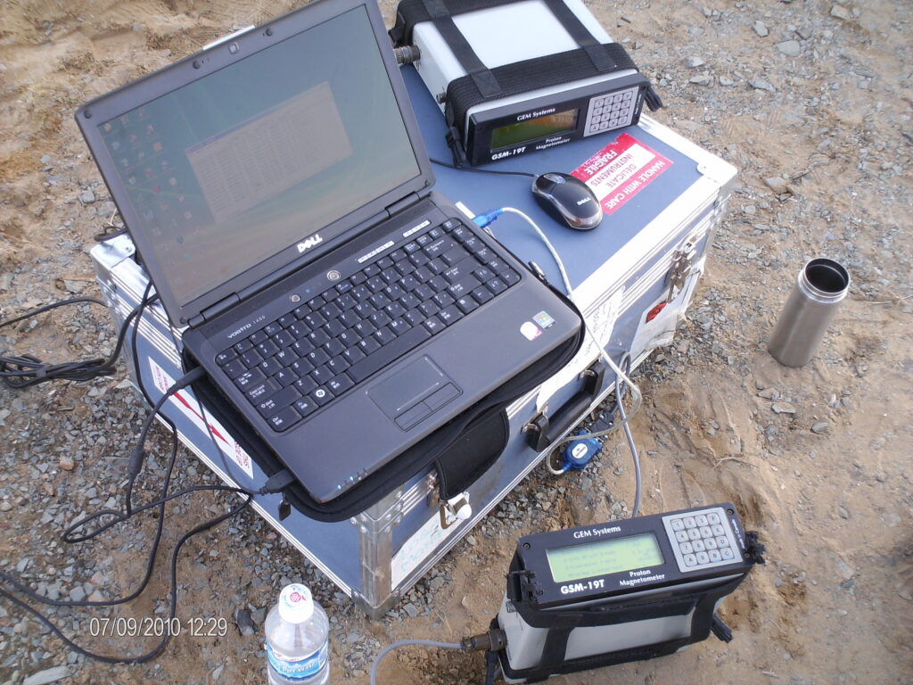
- Instrumentation: The survey involves the use of a magnetometer, which is a device that measures the strength and direction of the magnetic field.
- Data Collection: The magnetometer is systematically moved across the survey area, with readings taken at regular intervals. The spacing between measurement points depends on the objectives of the survey and the desired resolution of the data.
- Data Interpretation: The collected data is then analyzed to identify anomalies or deviations from the expected magnetic field. These anomalies can indicate the presence of subsurface features, such as ore bodies or geological structures.
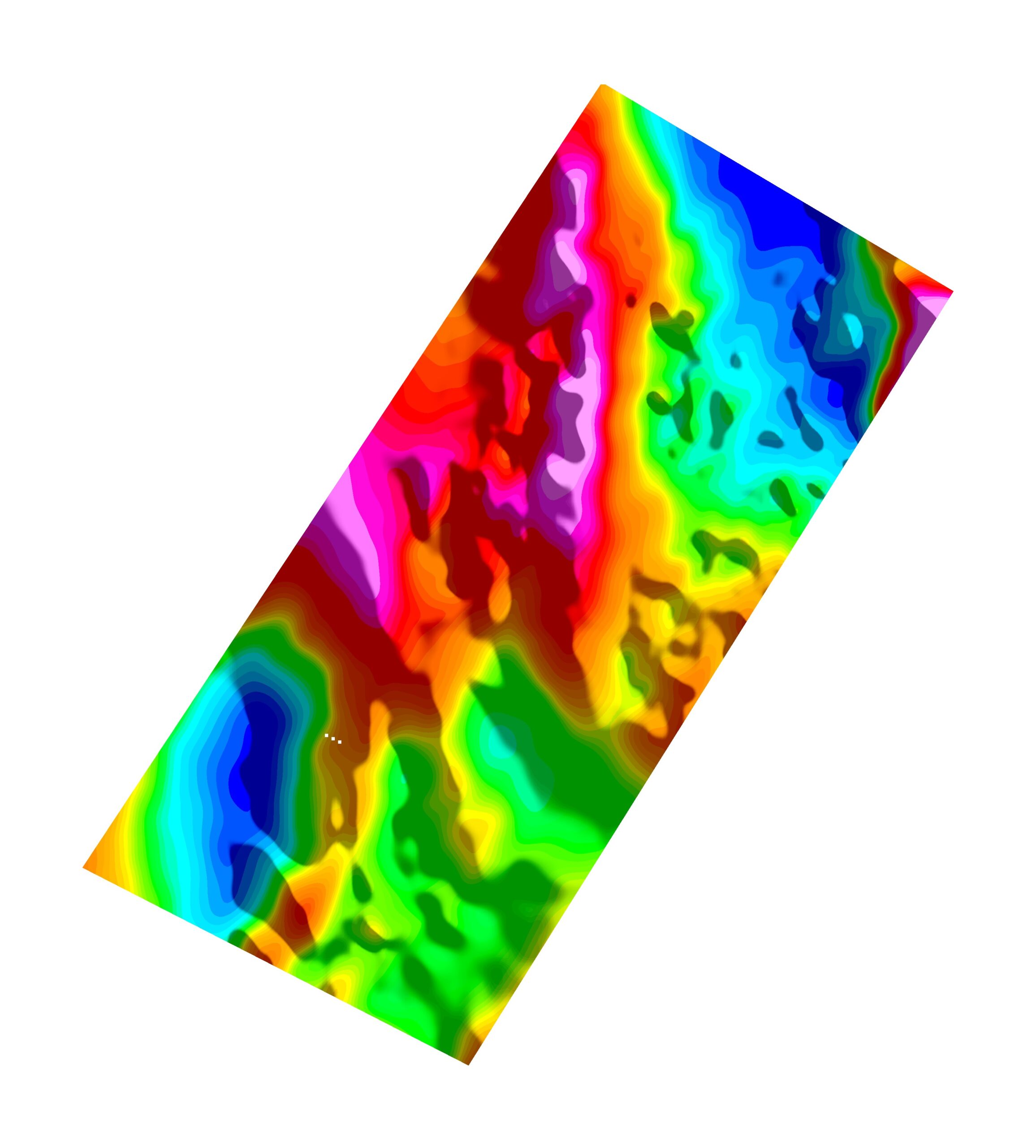
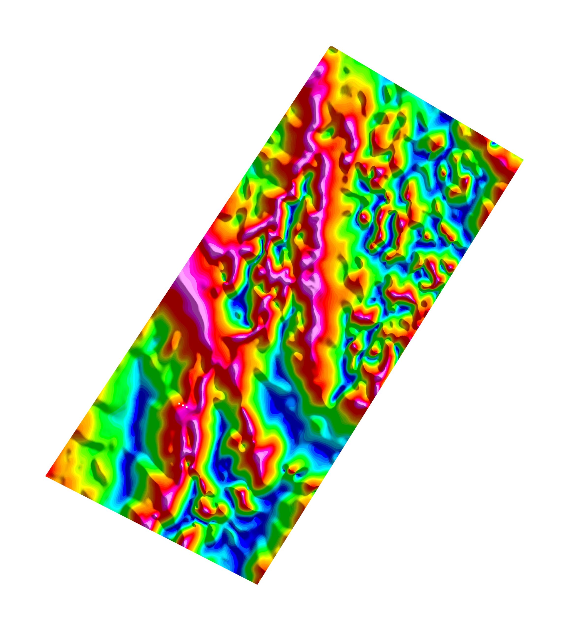
- Mapping: The results of the survey are often presented as contour maps, showing the distribution of magnetic anomalies across the surveyed area. Interpretation of these maps can help geologists and exploration companies identify potential targets for further investigation, such as mineral exploration or geological mapping.
Ground magnetic surveys are commonly used in mineral exploration, as certain types of mineral deposits can cause distinctive magnetic anomalies. They are also used in archaeological studies, environmental investigations, and geological mapping.